
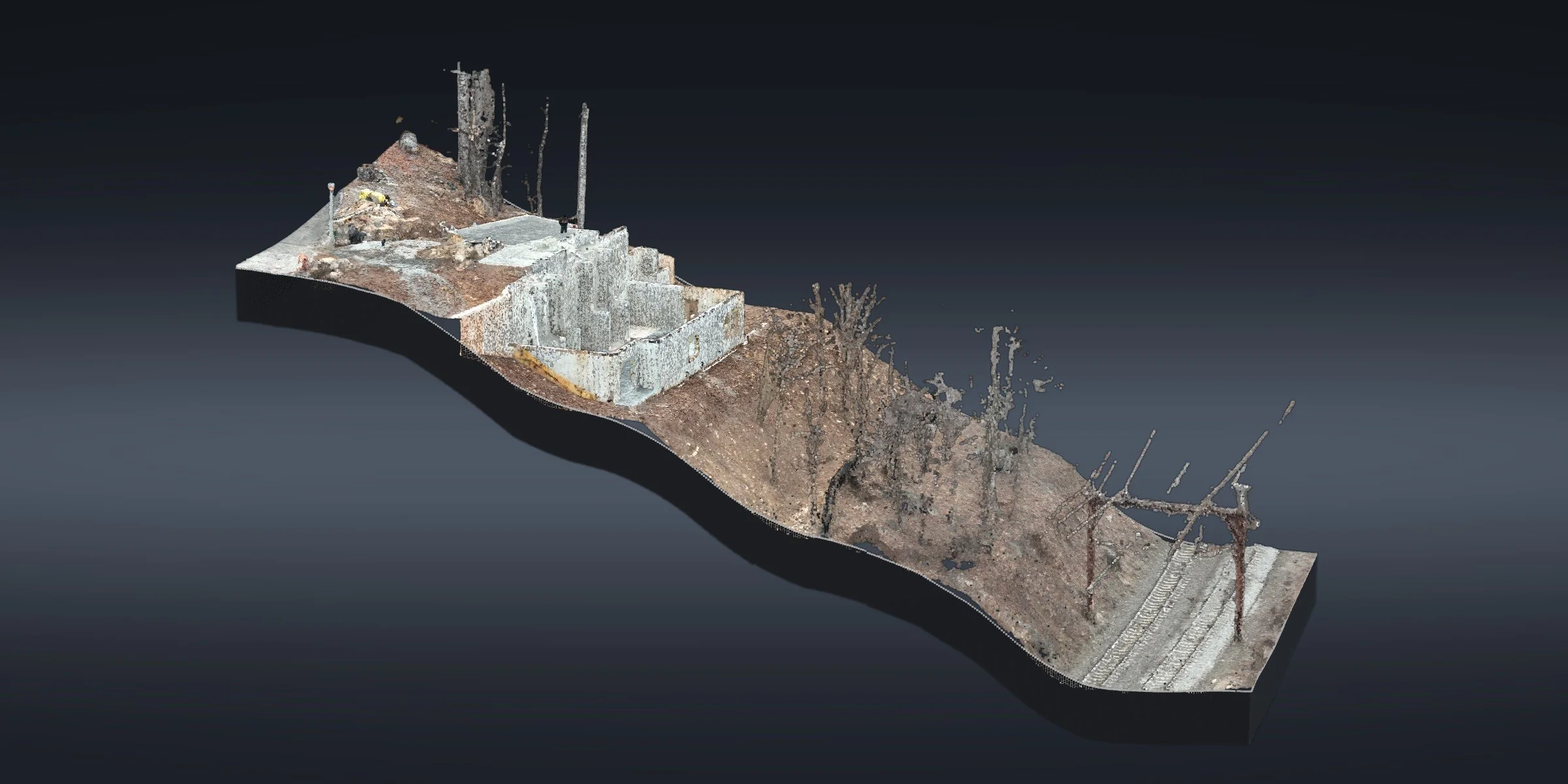
FOUNDATION SITE · MORRIS PLAINS, NJOver 50 Feet Down a Wooded Hillside, Morris Plains
A new foundation on a wooded hillside you don't want to walk. From the slab, the ground drops over 50 ft.
Over 50 ft of drop · Slope steeper than 2:1 · Quarter-inch ortho pixels · Foundation drafted in CAD
The site
This new foundation in Morris Plains sits on a steep, wooded hillside that's hard to access. From the slab, the ground drops over 50 ft, and the slope below the foundation runs steeper than 2:1. Walking a crew up and down that slope to pick up every corner is slow going.
What we did
We mapped it from the air instead. The flight captured the whole hillside in 3D: a point cloud and an ortho with quarter-inch pixels, from the street above to the bottom of the slope.
From that data we drafted every foundation corner and wall in CAD, with ground contours across the slope, so the licensed surveyor had what they needed for the as-built.
At a glance
Location: Morris Plains, Morris County, NJ
Site: new foundation on a steep, wooded hillside
Terrain: over 50 ft of drop from the slab; slope steeper than 2:1
Data: point cloud and an ortho with quarter-inch pixels
Drafting: foundation corners and walls, ground contours
Mapping and drafting in support of a licensed surveyor.
Have a steep or hard-to-reach site? Send us the site →
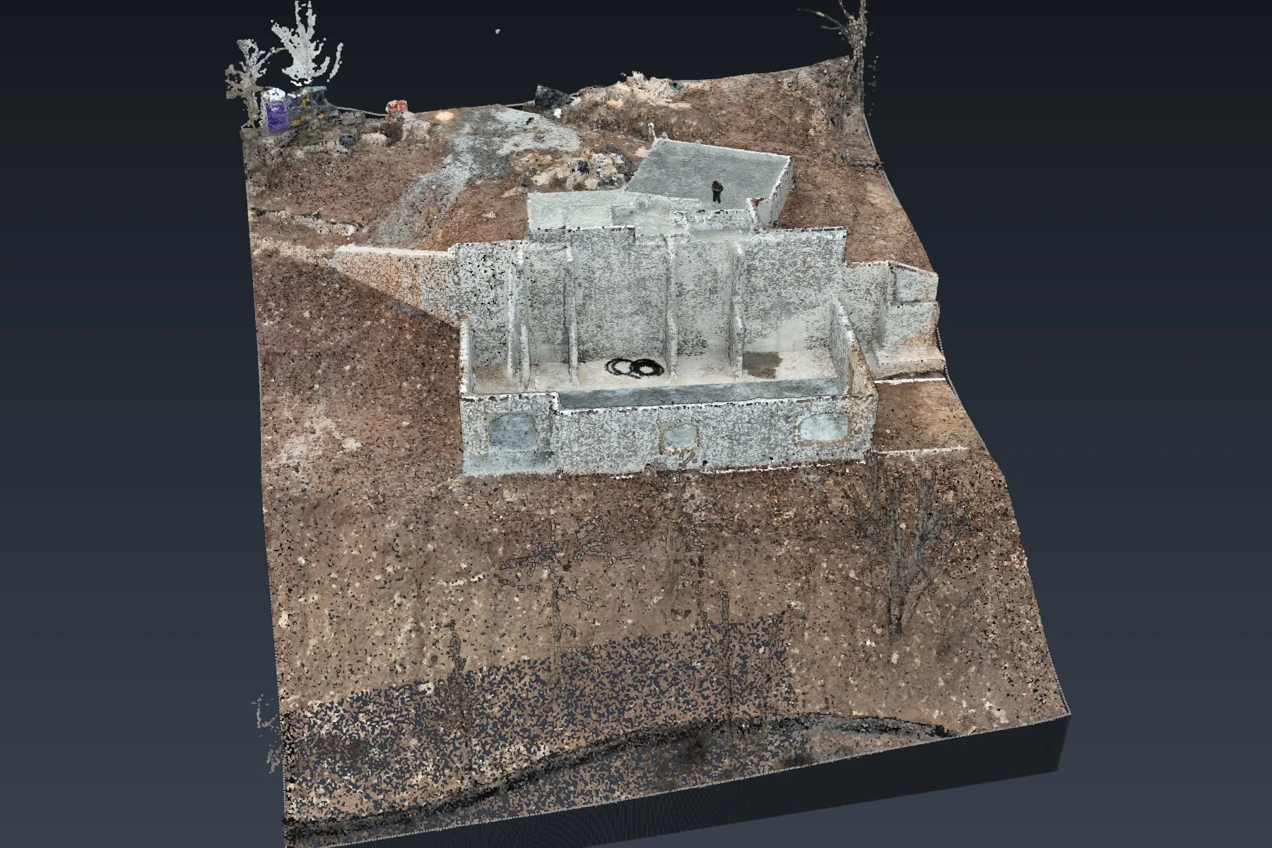
The new foundation in 3D, sitting on the hillside, rebuilt from the flight
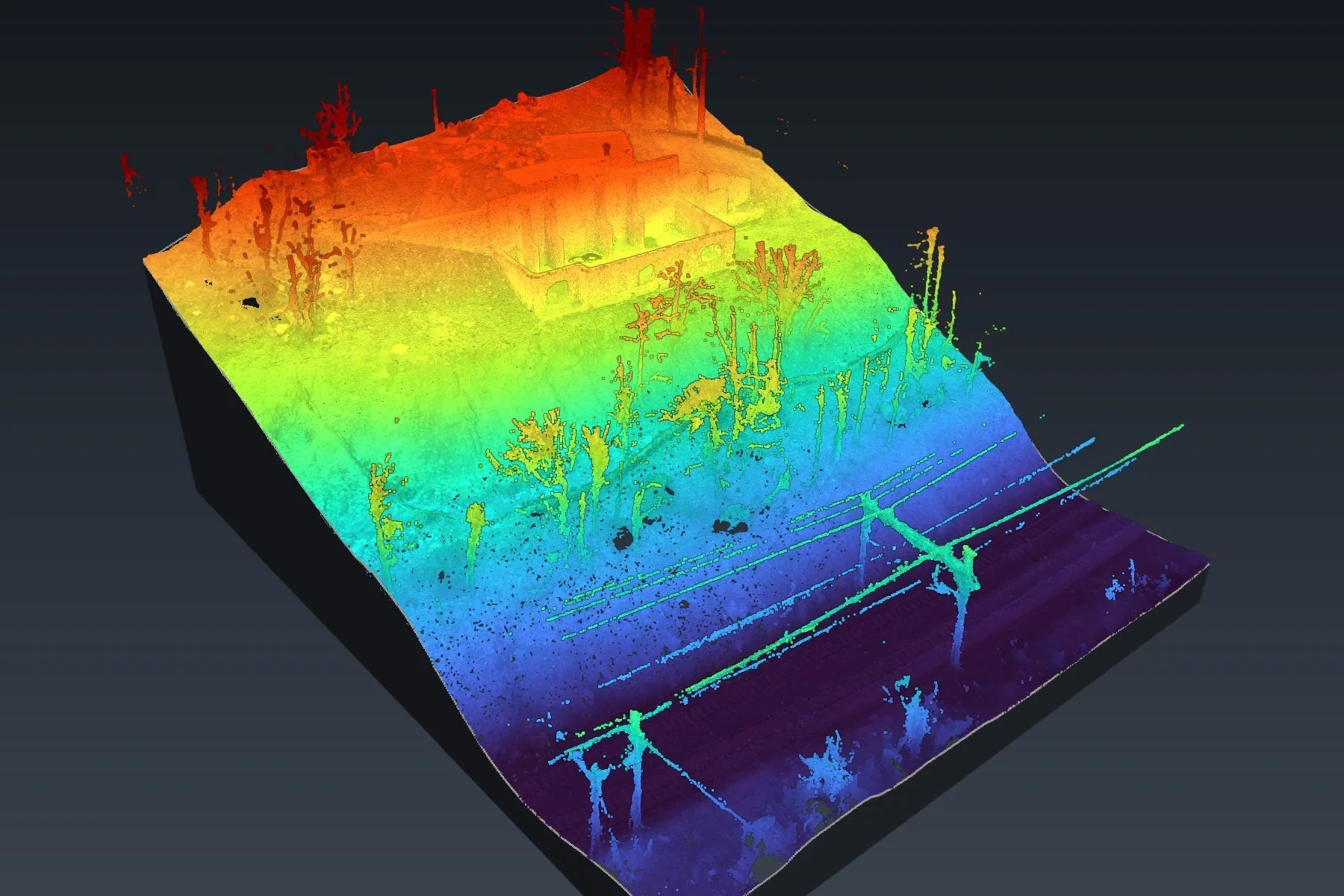
The slope colored by height, red at the slab down to blue at the rail line
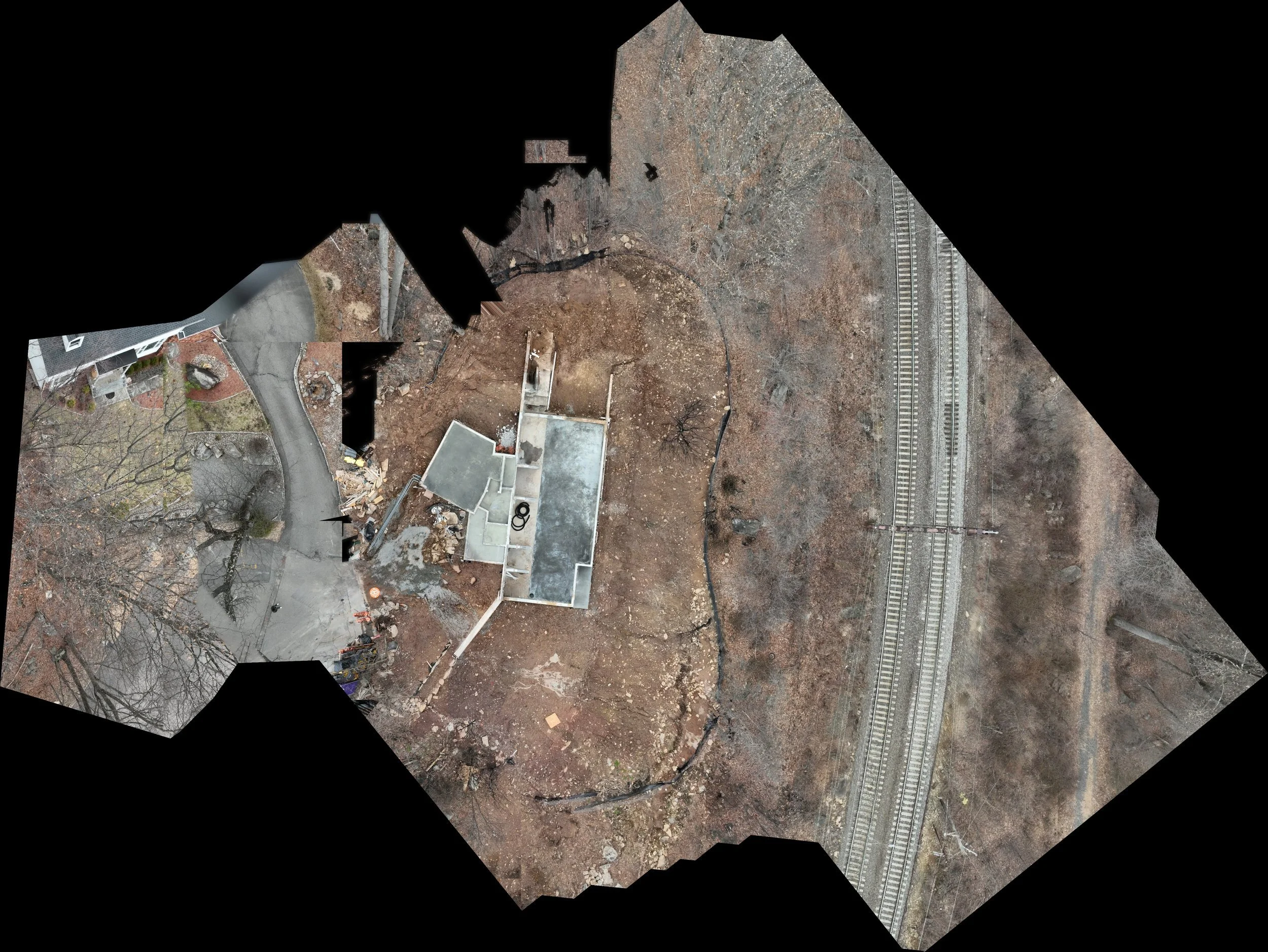
The whole hillside, from the street above to the bottom of the slope
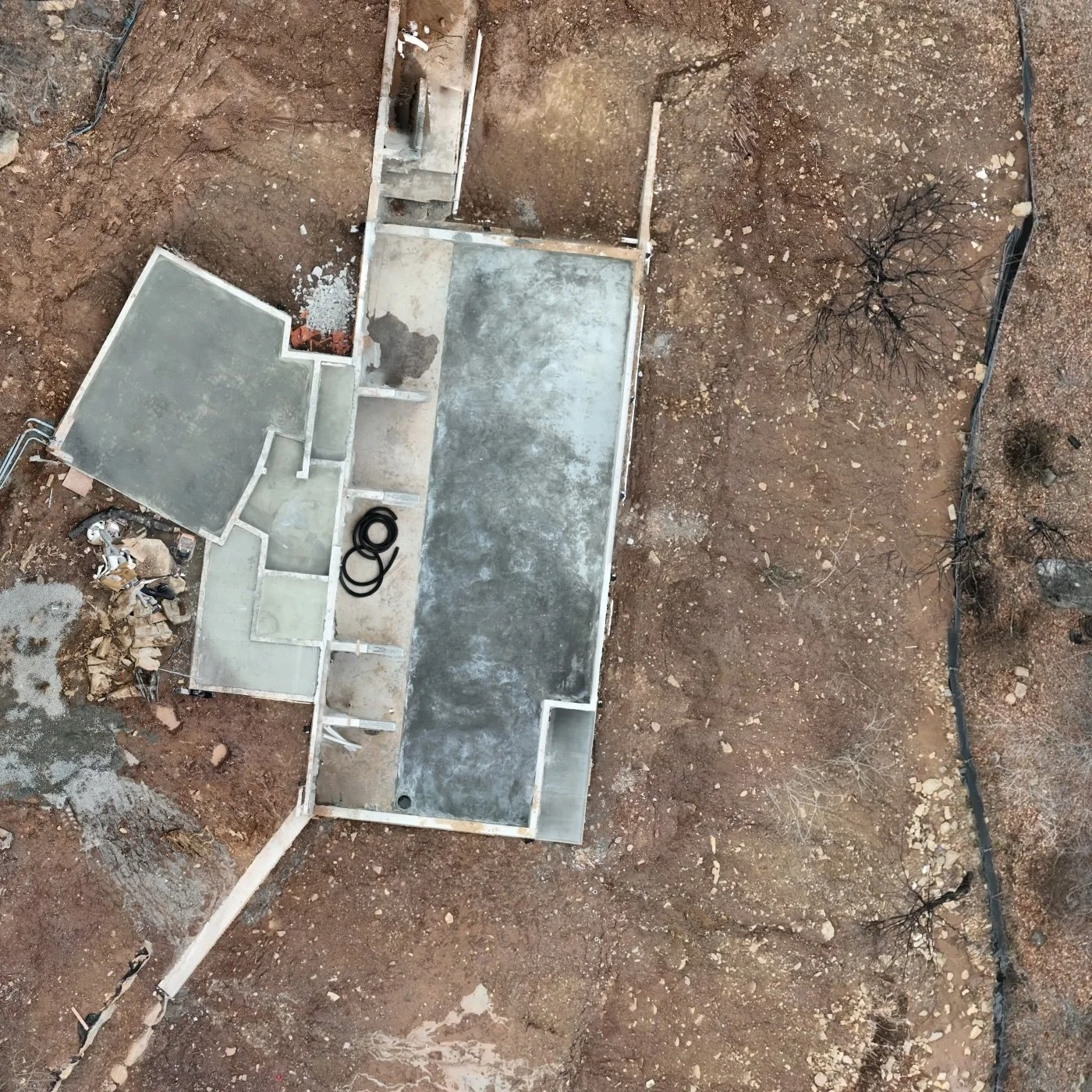
The new foundation up close: every corner and wall was drafted in CAD
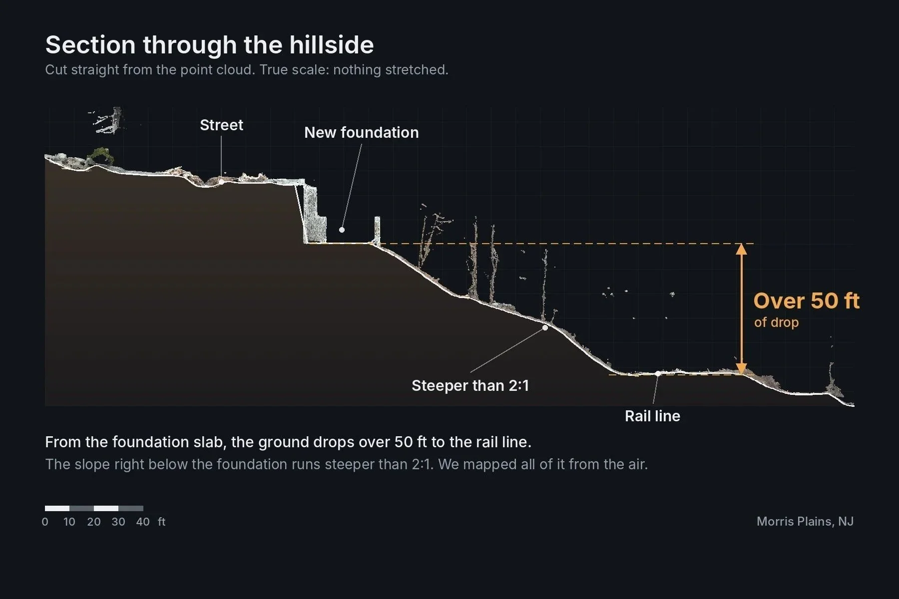
Section cut from the point cloud: over 50 ft of drop from the slab to the rail line
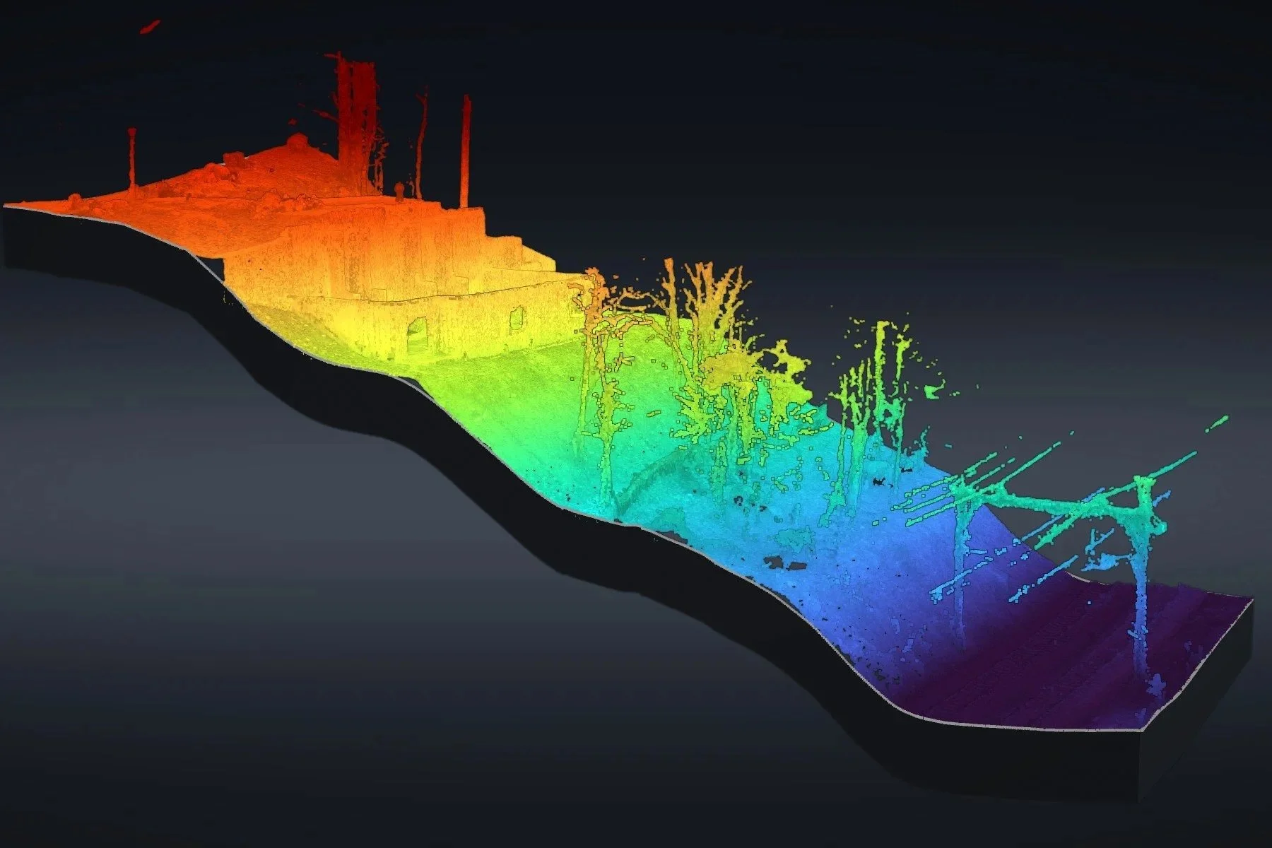
The whole hillside colored by height, from the street down to the rail line