CAD Drafting for Surveyors and Engineers
Site features, existing conditions and building drawings, drafted from drone data in your own template, ready for your licensed professional to review.
From point cloud to CAD
We fly the site, build the point cloud and draft what is on the ground: curbs, pavement, buildings, decks, fences and spot elevations.
You get clean linework in your layers and your title block, so your licensed professional can review it and finish the plan.
What we draft
Site features. Curbs, pavement, buildings, walls, fences and the rest of what is on the ground.
Curbs and spot elevations. Top and bottom of curb and spot elevations, for your surveyor's existing conditions plan.
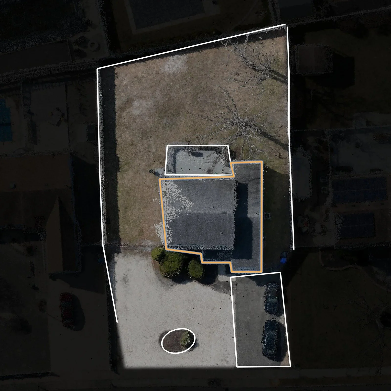
Residential lots. The house, deck, driveway, planters and fence lines, as a clean base for a plot plan.
Building elevations and floor plans. Exterior elevations drawn from drone photos, and floor plans from site measurements.
3D building models. A model of an existing building, so the design team can see its condition before design starts.
Drafted your way
Your layers and your title block
DWG files and a PDF set
NJ State Plane or your own grid
A check against the data before you see it
Recent drafting work
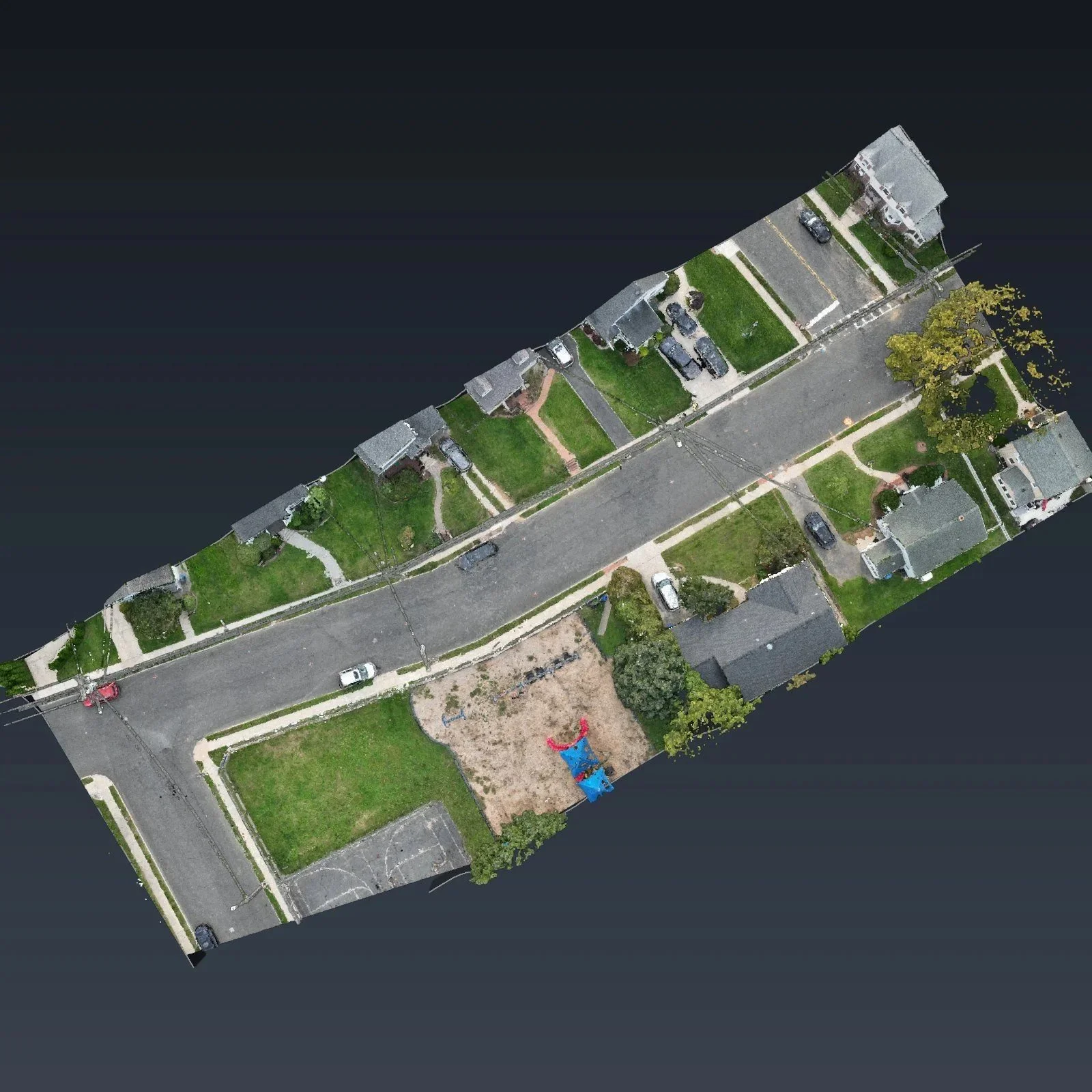
Street Mapping, South Amboy: a residential block, curb to curb. Flown on a Friday, drafted by Tuesday.
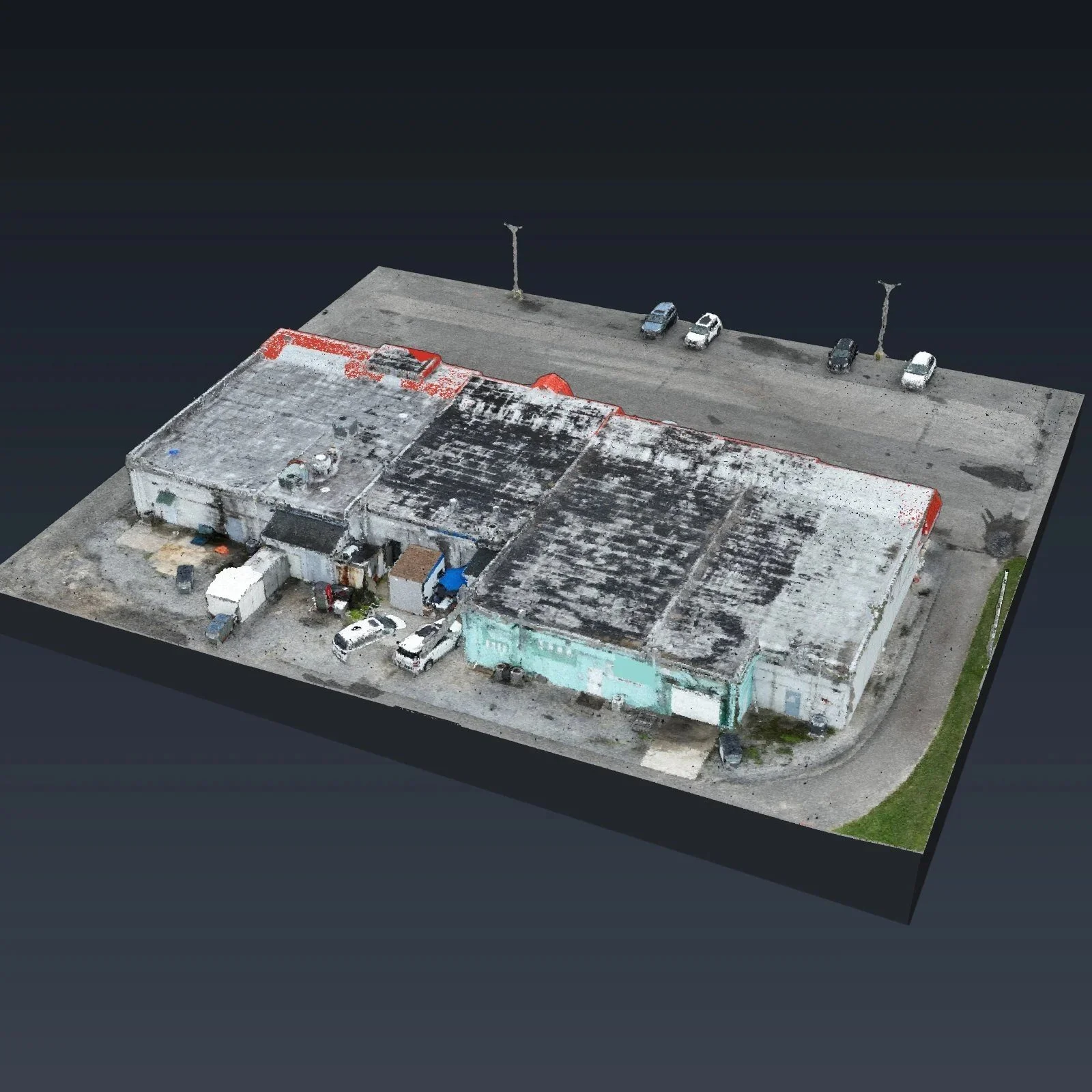
Commercial Lot, Ocean View: as-built linework and a 3D model of the existing building.
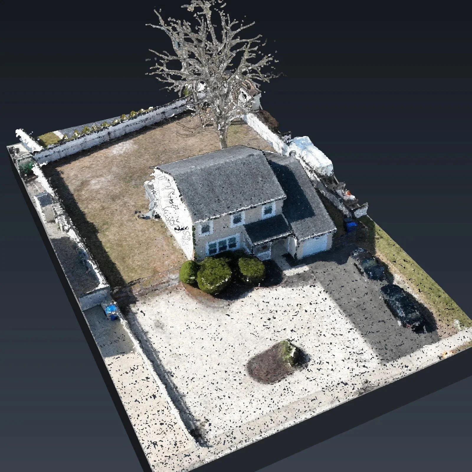
Home Lot, Toms River: a quarter-acre lot drafted clean for the plot plan.
House Drawings, Palisades Park: four exterior elevations and the floor plans, in one day.
Busy Lot, Ocean City: a 10 acre commercial lot mapped in one flight and drafted in CAD.
Recent drafting projects
Real New Jersey sites, shown by town and site type only.
Home Lot, Toms River
A quarter-acre home lot that had just changed hands. We drafted the house, the timber deck, the driveway, the planters and every fence line in CAD, so the surveyor had a clean base for the plot plan.
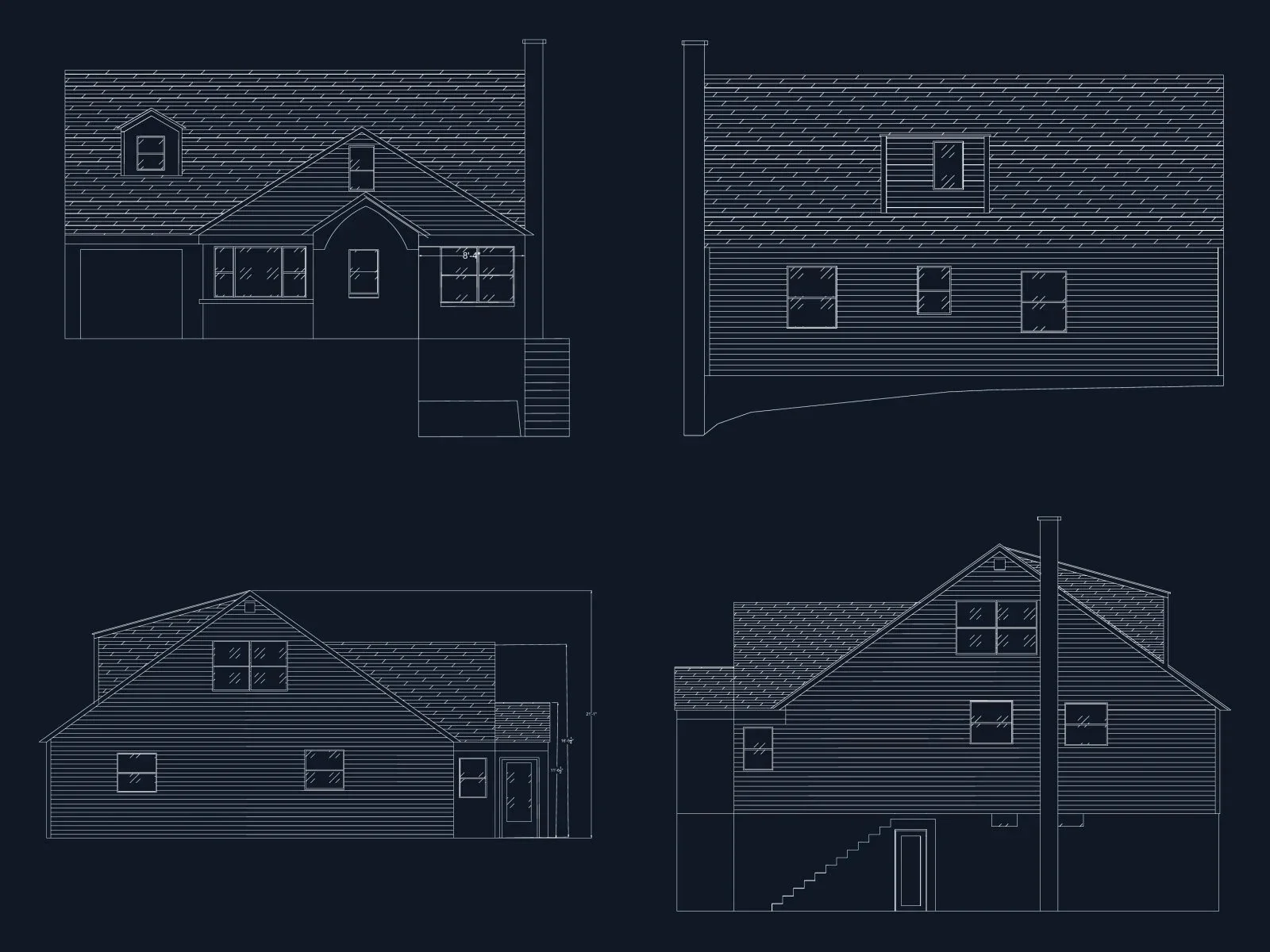
House Drawings, Palisades Park
Drone photos of a house turned into all four exterior elevations, plus floor plans for both floors and the basement, all in one day, ready for the engineer to work from.
How a job works
Send us the site. The town, the rough size, what you need drafted and when you need it.
We agree on the scope. What gets drafted, your template, your grid and the due date.
We fly it and draft it. Our FAA Part 107 certified pilot captures the site, and we draft it to your template. See Drone Mapping.
You review it. Your licensed professional checks the drawing, asks for changes and keeps the seal.
You stay in charge
We capture data and we draft. We do not make the calls on the land. Boundary work, monuments, utilities, field checks and the seal stay with your licensed surveyor or engineer. Innovize is not a land surveying or engineering firm.
Questions
Can you match my template?
Yes. Send us your layers and title block, and we draft to them.
Can you work in NJ State Plane or my own grid?
Yes. Tell us which one when you send the site.
What do you need from me?
The town, the rough size, what you need drafted, who seals and when you need it.
Who seals the drawing?
Your licensed professional does. We never seal anything.
Have a site that needs drafting? Fill out the form below and we reply within one business day.
Mapping and drafting in support of a licensed surveyor.