Drone Mapping for Surveyors and Engineers
Point clouds, orthomosaics and 3D models of your New Jersey site, flown by an FAA Part 107 certified pilot and tied to the control your surveyor sets.
The whole site, from one flight
A crew on foot picks up a site one shot at a time. A drone picks up the whole site at once: the pavement, the roofs, the slopes and the stockpiles, including the spots that are slow or unsafe to reach on foot.
Your crew spends less time in traffic, and your licensed professional gets data to work from.
What you get
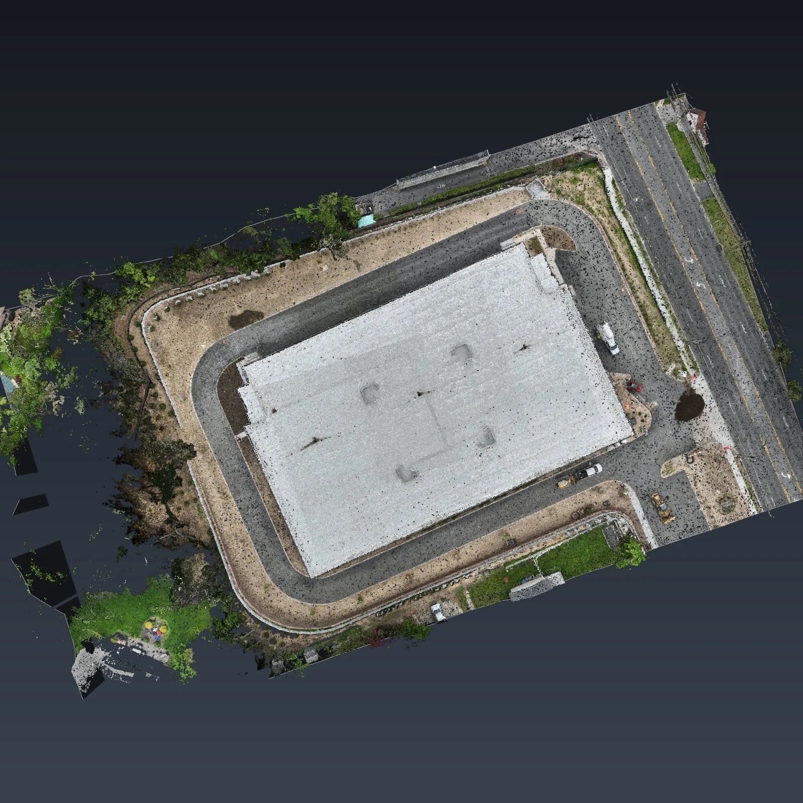
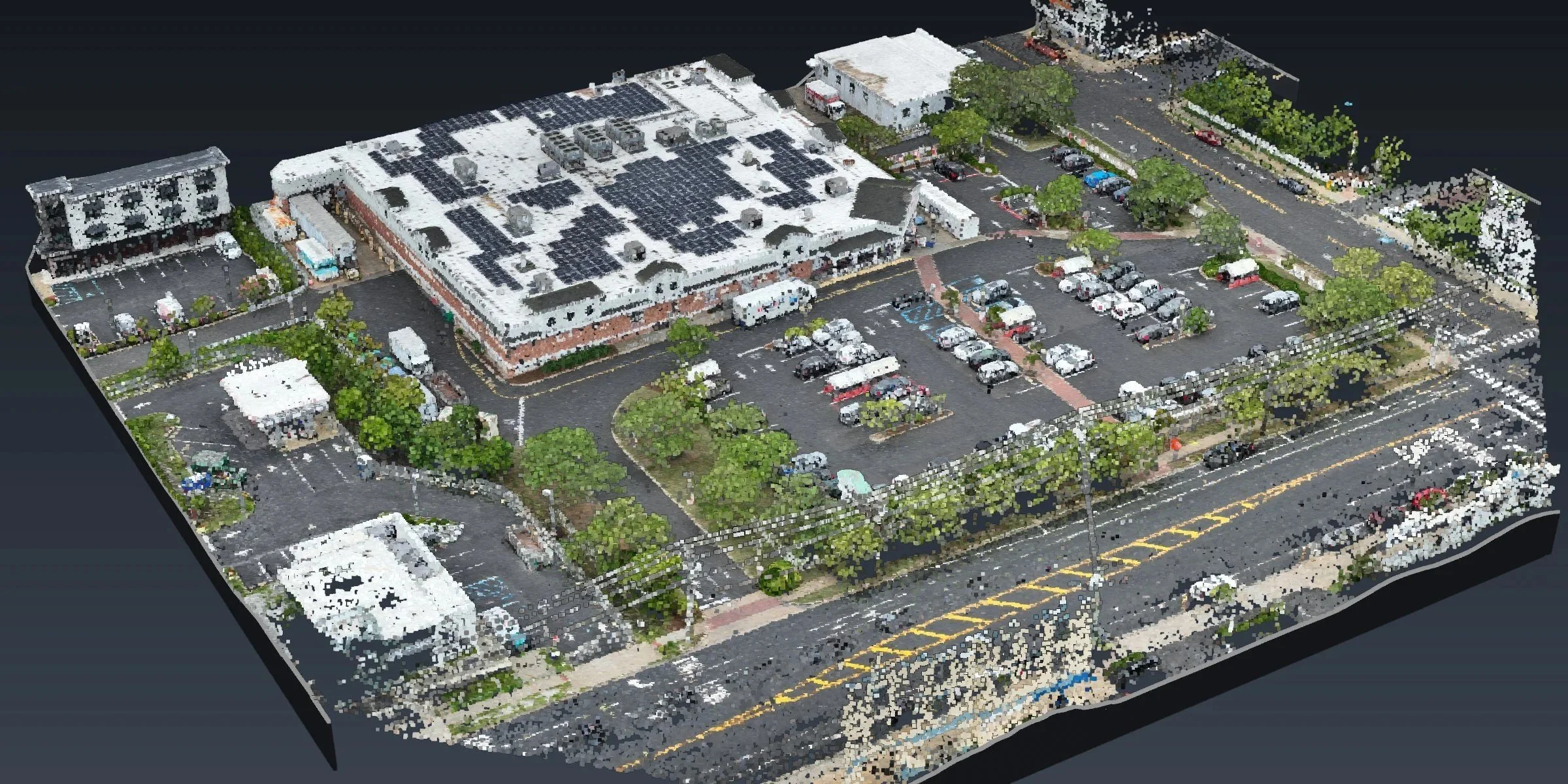
Point cloud. The site in 3D: every curb, roof and slope, in LAS format.
Orthomosaic. One sharp, straight-down image of the whole site, in GeoTIFF format.
3D model. A model of the site or a building that the whole design team can look at.
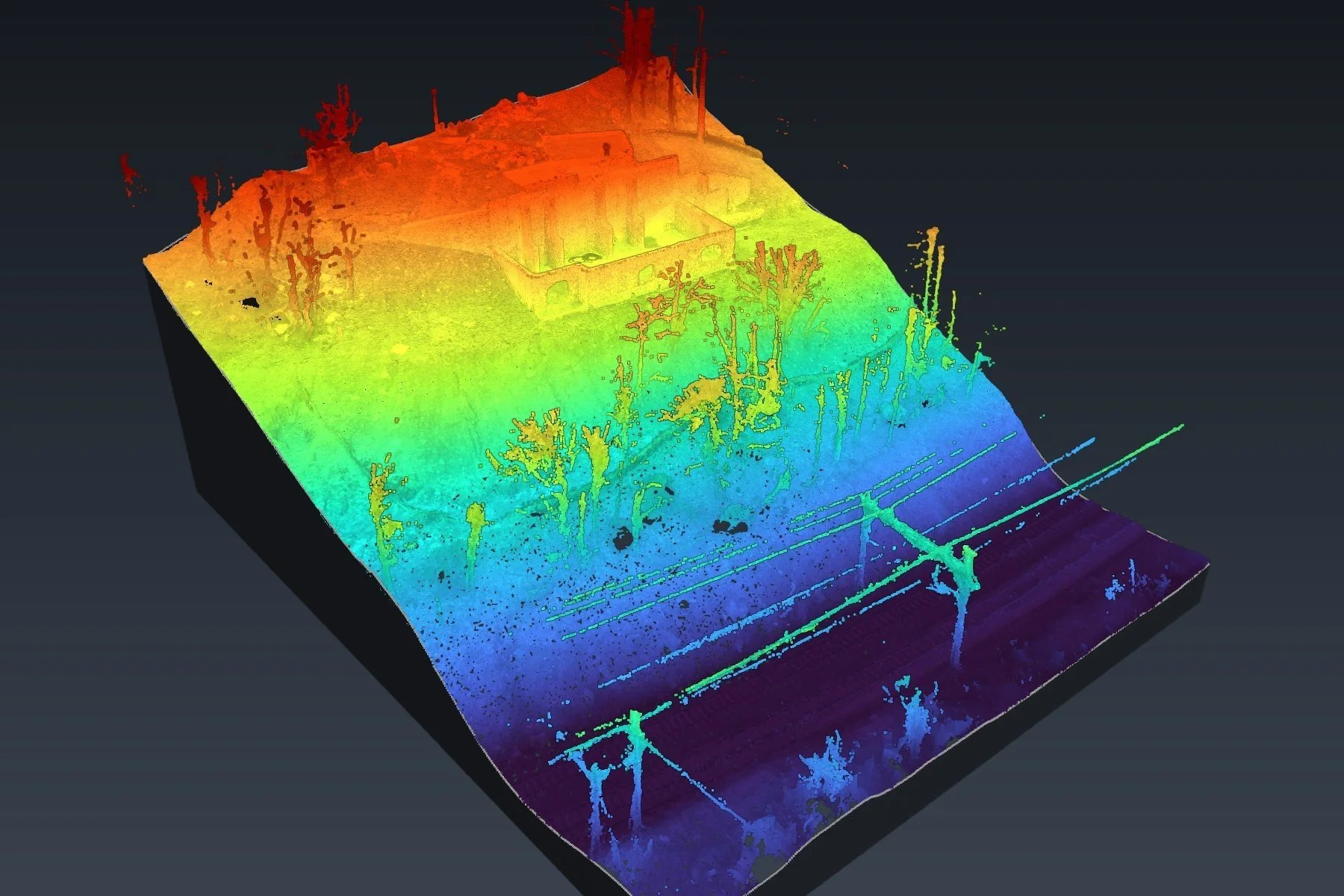
Surface model. For yards and stockpiles, a surface your surveyor can run volumes from.
CAD drafting, if you want it. We draft the site features in your template. See CAD Drafting.
We work in NJ State Plane or your own grid, tied to the control your surveyor sets.
Sites we map
Parking lots and plazas. Busy Lot, Ocean City and Busy Plaza, Cherry Hill, each mapped in one flight while the lot was full.
Commercial sites. Commercial Site, Bordentown, Large Site, East Brunswick and Commercial Lot, Ocean View.
Stockpile yards. Stockpile Yard, Camden: a yard of 18 piles, mapped in one flight.
Streets. Street Mapping, South Amboy: a residential block, curb to curb.
Waterfront lots. Lagoon Lot, Stone Harbor: a deck, a bulkhead, piers and a floating dock.
Steep and wooded sites. Steep Slope, Morris Plains: a hillside with over 50 ft of drop.
Home lots. Home Lot, Toms River: a quarter-acre lot, drafted clean.
Jobsites under construction. Construction progress photos on a set schedule.
Recent mapping projects
Real New Jersey sites, shown by town and site type only.
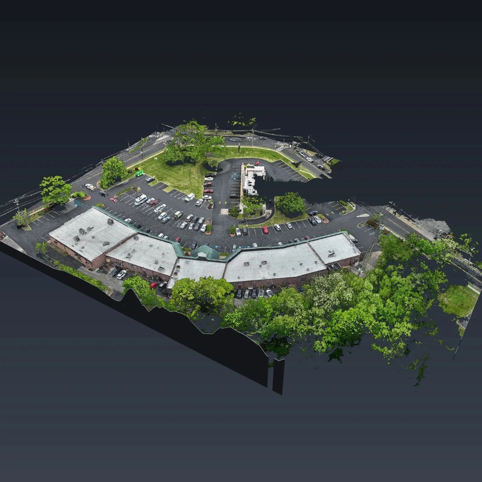
Busy Plaza, Cherry Hill
A 6.6 acre shopping plaza with a full parking lot, mapped in one flight. Every stall, curb and roof is in the point cloud, ready for the surveyor to draft from.
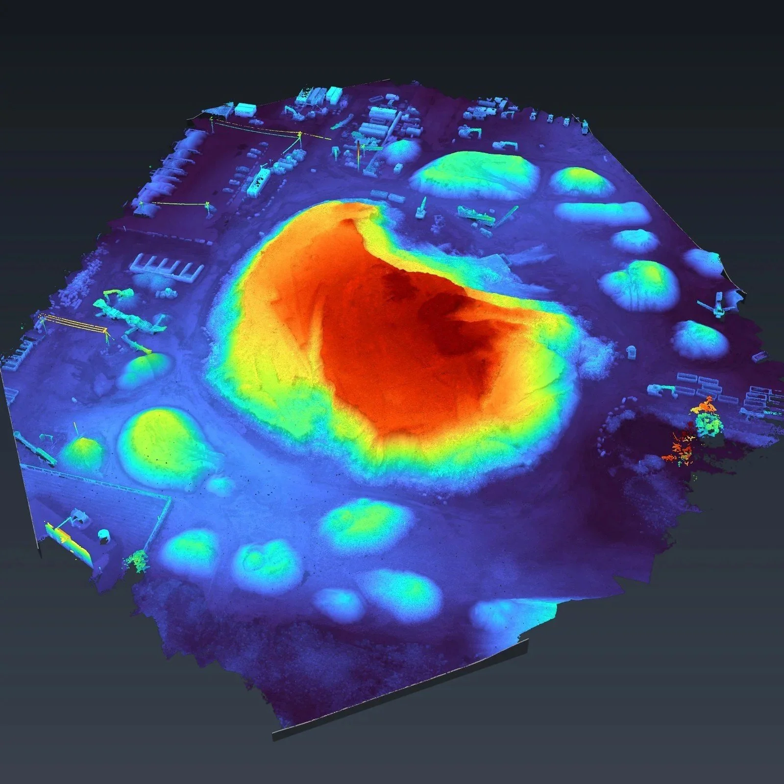
Stockpile Yard, Camden
A yard full of stockpiles, one of them 56 ft tall. We mapped the whole yard in one flight and delivered a surface the surveyor can run volumes from.
How a job works
Send us the site. The town, the rough size, what you need and when you need it.
We check the site. We tell you if it works from the air, and where your crew should add points, like dense trees or the water's edge.
We fly it, tied to your control. Our FAA Part 107 certified pilot captures the site. Many sites take a single flight.
We process it and send it. You get the files we agreed on, in your grid.
You check it. Your licensed professional reviews the data and keeps the seal.
You stay in charge
We capture data and we draft. We do not make the calls on the land. Boundary work, monuments, utilities, field checks and the seal stay with your licensed surveyor or engineer. Innovize is not a land surveying or engineering firm.
Questions
Can you work in NJ State Plane or my own grid?
Yes. Tell us which one when you send the site.
What about trees and water?
Dense trees and water edges are hard to see from the air. We tell you where they are, so your crew knows where to add points.
How big a site can you take?
We mapped a 10 acre lot in one flight. Send us the site and we will tell you if it fits.
Where do you work?
Across New Jersey. Our projects run from Bergen County down to Cape May County.
Who seals the work?
Your licensed professional does. We never seal anything.
Have a site to map? Fill out the form below and we reply within one business day.
Mapping and drafting in support of a licensed surveyor.