
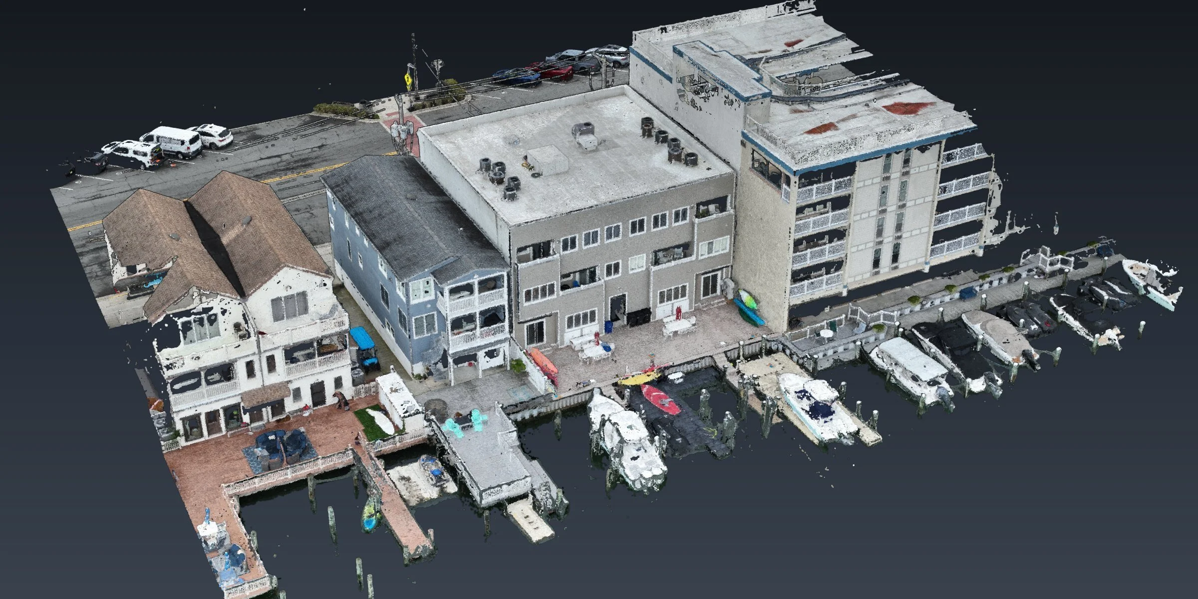
WATERFRONT · STONE HARBOR, NJThe Bulkhead Hiding Under the Deck, Stone Harbor
A building, a timber deck, a bulkhead, fixed piers and a floating dock, all packed into one tight lagoon lot.
Point cloud · Data from every angle · CAD base plan in DWG and PDF
The site
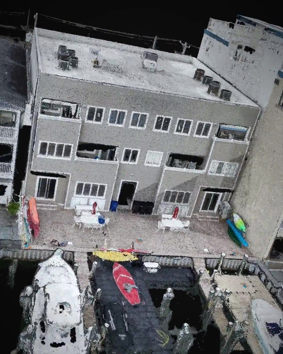
Waterfront lots look simple from the air. This one wasn't. Everything sits within a few feet of the water, the lot is hard to access, and from above the deck and the bulkhead read as one line.
A total station crew could pick it all up, but that takes time on a lot this tight. So we flew it.
What we did
Our FAA Part 107 certified pilot captured data from every angle, so the edges a top-down view hides are in the point cloud. Ground targets were tied to the surveyor's control.
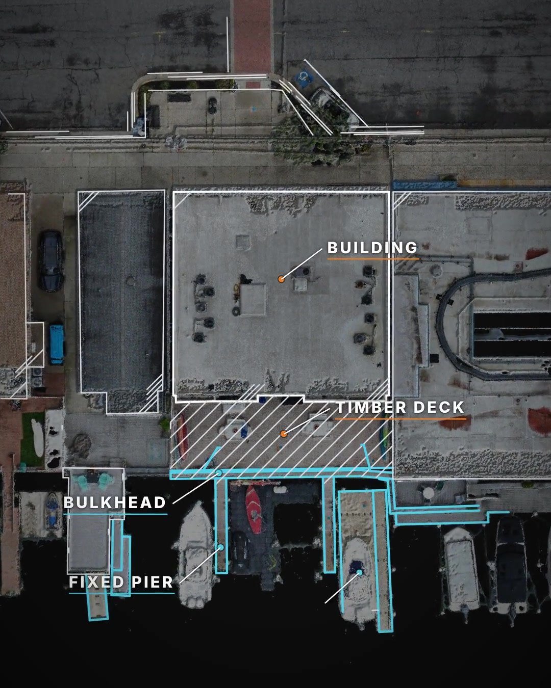
The deck and the bulkhead sit at different elevations, so we separated them in the point cloud and drafted each as its own feature. The building, the timber deck, the bulkhead, the fixed piers and the floating dock are all on their own lines in the CAD base plan, prepared in DWG and PDF for the surveyor's own checks.
At a glance
Location: Stone Harbor, Cape May County, NJ
Site: lagoon lot with a building, timber deck, bulkhead, fixed piers and a floating dock
Control: ground targets tied to the surveyor's control
Data: point cloud captured from every angle
Drafting: CAD base plan, every feature on its own line, DWG and PDF
Mapping and drafting in support of a licensed surveyor.