Sealed Topo Survey + Foundation As-Built
Long Beach Towns
hip, NJ
Client: Ken Schmidt Construction | Location: 2904 Atlantic Ave, Long Beach Township, NJ (coastal zone) | Service: Sealed Topographic Survey + Foundation Location As-Built | Deliverable: Sealed DWG + PDF, NAVD 1988 vertical datum
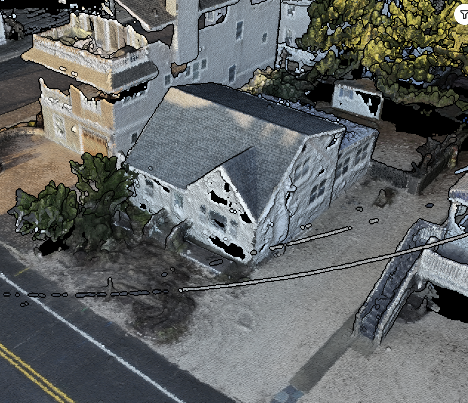
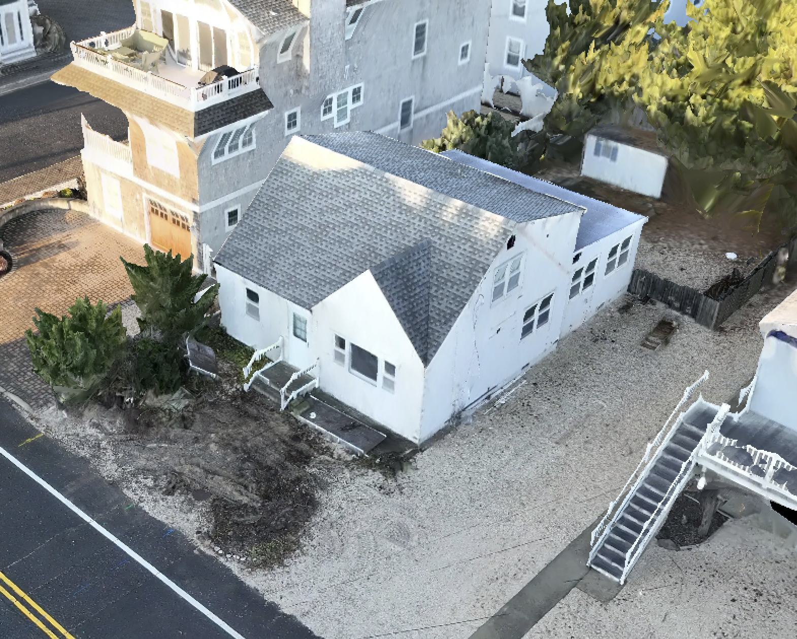
Ken Schmidt Construction needed a sealed topographic survey and foundation as-built for a new 3-story coastal residence in Long Beach Township — a jurisdiction with strict FEMA floodplain and CAFRA requirements. Innovize deployed RTK/PPK ground control across the site and captured 1-foot contour topo data via drone photogrammetry. We simultaneously documented the as-built foundation location relative to property lines and confirmed minimum finished floor elevations per NAVD 1988. Deliverables included a sealed DWG and PDF signed by our NJ Professional Land Surveyor, accepted by the township building department for permit approval.
A topographic survey maps the existing conditions of a site — including ground elevations, surface features, and permanent structures — so engineers and architects can design with confidence. It's the starting point for almost every civil project: grading, drainage, utilities, site layout, permitting, and more.
We use drone photogrammetry combined with surveyed ground control to produce high-resolution elevation data quickly and accurately. Unlike old-school methods, we don’t need to wait for a field crew to walk the entire site. We can fly it in less than an hour and have CAD-ready surface data within 24–48 hours.
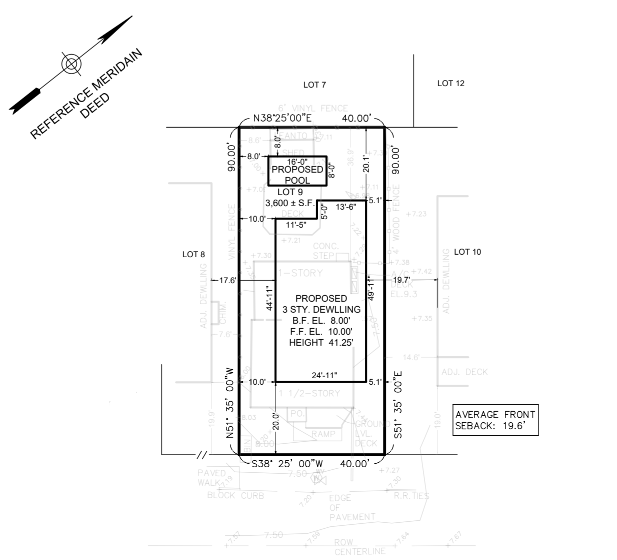
CAD-ready deliverable prepared for design coordination and construction use.